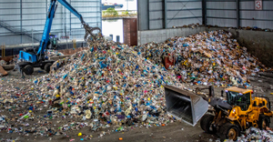
EPA Detects Radioactive Contamination on Edge of Bridgeton Landfill
March 25, 2016
St. Louis Public Radio
Radioactive contamination at the West Lake Landfill has been detected further south than previously reported, according to data released Thursday by the Environmental Protection Agency.
The new map shows contamination on the northern edge of the Bridgeton Landfill, a few hundred feet away from an underground smoldering fire that has existed since at least 2010. The contaminated soil, left over from the Manhattan Project, is about 70 to 80 feet underground in the newly discovered area, officials said.
"There’s still no significant health risk posed by the radiological waste. The health risk for both onsite workers and folks offsite hasn’t changed,” EPA project manager Brad Vann said on a conference call with reporters.
The findings are part of an extensive, long-awaited survey of contamination at the West Lake Landfill Superfund site. The data will help the EPA determine where to build an isolation barrier between the waste and the underground fire, which is burning in the Bridgeton Landfill’s southern quarry.
You May Also Like


