Stay in the Know - Subscribe to Our Newsletters
Join a network of more than 90,000 waste and recycling industry professionals. Get the latest news and insights straight to your inbox. Free.
November 1, 2002

Michael Fickes
Landfills don't often make poor neighbors. To persuade residents of a new housing development in Brea, Calif., that this is true and its nearby Olinda-Alpha landfill should be welcome in the community, the Integrated Waste Management Department of Orange County decided to commission three landfill models from Solid Terrain Modeling Inc. (STM), Fillmore, Calif.
Unlike conventional models that usually take months to construct, STM's models provide an accurate representation of the terrain, highways, housing and everything else around a site that might elicit scrutiny from unwilling neighbors — in just about a week.
STM uses its patented technology to sculpt the models from dense foam blocks using a machine that works like a giant router. After sculpting, the models are coated with a liquid paper spray. Next, a color printer with inkjet heads capable of moving up, down and around the form's topographical features prints the image of an aerial photo onto the model. The printer matches each photo peak to model peak, valley to valley, road to road and even house to house. Lastly, an artist's rendering of what the landfill will look like when it closes is overprinted on the landfill area.
To create the models, the Integrated Waste Management department supplied Digital Terrain Design Inc., San Clemente, Calif., with a CD containing recent aerial photographs and gradient AutoCAD drawings of the landfill. STM's software “translates this data into information for the milling machine and the printer,” says John Paez, Digital Terrain president and an STM investor. Digital Terrain then used the information and STM's technology to produce the three Olinda-Alpha models as well as models for each of Orange County's other two landfills.
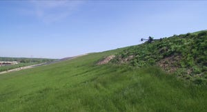
According to David Lowry, Olinda-Alpha site manager, the models could have been useful in showing the working face of the landfill. However, they were even more useful in illustrating the distance between the landfill and the surrounding communities, as well as the benign nature of landfill's presence after closure, which will become a field similar to the surrounding lightly forested grasslands.
In each 2-foot by 3-foot model, 1-inch equals 800 feet, covering an area approximately 4 miles by 6 miles, Paez says.
“The first of the three models shows a regional view of the landfill in relation to three small cities and the 57 freeway,” Lowry says. “We had the freeway incorporated because there have been public discussions about finding different access to the landfill. This model helps make the point that the route we are using is the one we have to take.”
The same data also helped to create the other two Olinda-Alpha models, one of which is a close-up view of how the landfill will look after closure in 2013. The third model provides a close-up view of the landfill's features after closure if an expansion is carried out.
Orange County has permitted Olinda-Alpha for a vertical and horizontal expansion, which would extend the closure date to 2022. When residents compare the models of the current and expansion closures, they can see that an expansion would not significantly alter the effect of the landfill on surrounding communities, Lowry says.
According to Digital Terrain, STM models cost an estimated $2,000, depending on their size and complexity. However, the cost is significantly lower than conventional models that run significantly higher. And Linda Hagthrop, public information officer for the Integrated Waste Management department, says the models have been useful at public meetings when discussing Orange County's expansion plans.
“The exhibits help people feel more comfortable with the expansion,” she says. “They see that the expansion has limits, that it stays within our existing property boundaries. The models also illustrate how high the vertical expansion will go. Using the three models, people can compare the height of the expansion with the height of the existing landfill. They can also see how much higher the expansion will be in comparison with the surrounding landscape.”
Additionally, residents will notice that Olinda-Alpha occupies the back of a canyon relatively remote from the housing developments. In fact, people can see that the horizontal expansion will occur on the far side of the existing landfill, away from the housing developments, Hagthrop notes.
When the models are not being used at public meetings, Hagthrop keeps them in her office. But Lowry wants them back; he shows the models to residents who frequently come in to ask about the facility.
“People don't realize there is a landfill up in the canyon until they notice our trucks,” he says. “That's good. We don't want our operation to get in the way. But when people do notice, they have questions. The models are a big help. You can even find your house on the model and see how far away the landfill really is.”
Unless the department decides to commission more models, Lowry and Hagthrop will have to settle for joint custody.
You May Also Like