SCS Engineers’ Staff Scientist Ian Jimeno explores how technology can help fieldworkers perform their jobs more efficiently.
March 25, 2020

Ian Jimeno
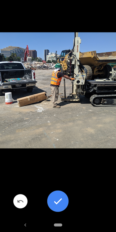
A day on a construction site demands the full attention of every fieldworker. From working in close proximity, to constantly moving heavy machinery, to environmentally sensitive soil exposed while grading, fieldworkers need ways to make days less intense without compromising safety or efficiency.
In the case of environmental technicians, profiling the integrity of the soil before grading is crucial to keeping construction schedules. Finding the right soil-boring locations near features of potential concern or areas of known contamination must be done without wasting excavators’ time. How can field technicians do that while holding dozens of documents for soil logging, a few field instruments or sampling equipment? After the locations are plotted on a map, how can you easily transfer the data into the form of a report?
The answer: by using ArcGIS. Our teams constantly look for technology that can help us work more efficiently.
The Tech
ArcGIS is a geographic information system (GIS) that lets you work with maps and geographic information maintained by Esri. You can use it to create maps, compile geographic data and analyze mapped information. Although ArcGIS is widely used in offices nationwide, not many companies are using its mobile applications, which can make life as a field tech much easier.
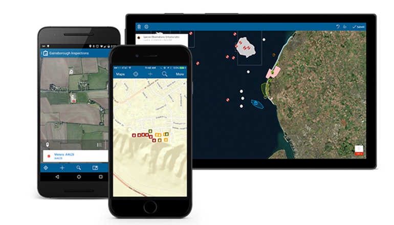
ArcGIS developed the Collector app for fieldworkers to reduce the stress and headache of collecting and transferring data while in the field. Collector allows the environmental technician to prepare the field map to be displayed on a mobile device (i.e. tablet or phone) and add the boring locations to the map through the mobile device. ArcGIS also made the transition between locating the points of interest in the field and transferring the data to a report-like format seamless. You can then do more polishing through ArcMap, which lets you create, edit and analyze your geospatial data. SCS Engineers has implemented this technology to save hours in time and budget spent drafting and compiling reports.

How it Works
I first used this technology on a site in Burbank, Calif. The site was approximately 9 acres planned for commercial use with underground parking. Before the footing and underground parking excavations could begin, the property had to be evaluated at various locations within the existing building footprint.
The problem is that by the time I was due to be onsite to profile the soil, the building would be demolished. I would have no way of navigating around the site. I captured a Google Earth map on Collector with the building still standing to provide some context. I thought this project was perfect to put Collector to the test. After all, we all have a GPS device in our pockets: a smartphone!
To set up my field map, I used ArcGIS Online to create a feature layer. The feature layer let me place features of concern, utility lines, previous/current underground storage tanks (USTs) and, most importantly, sample locations on the field map. For each item I wanted to identify while in the field, I created an icon. For example, the utility lines are dashed lines, shallow sample borings are yellow dots, deep sample borings are red dots and USTs are red polygons. I downloaded Collector to my phone and logged into my ArcGIS Online account. I was ready to go out into the field and plot each location through my phone.
We all use our phones for navigation. Collector uses the same technology to detect where you are. While I was out in the field, I was able to stand right over a shallow boring sample location, click on my location and place the appropriate icon (in this case, a yellow dot). I was able to include my own soil-related comments and pictures dedicated to each sample location. The additional details were filled in by the Assisted GPS technology, such as approximate elevation above sea level, number of satellites used to pinpoint the location and the latitude and longitude. Note that it is not 100 percent accurate. There is some variance with the accuracy when using the GPS locating on your phone: approximately 5 to 10 feet. I knew this variance existed when I went to the site, and, based on the size of the site, a variance of 10 feet was not going to throw off the integrity of the screening. The lack of accuracy was rather obvious while outlining the USTs in the field, however.
Additional hardware can be implemented while out in the field to decrease the error significantly. The Collector app can pair with a third-party device such as a Trimble to reduce the error to approximately 10 centimeters. For the sake of this project, and because of the experimental nature of using this technology for the first time, the project team and I decided the phone GPS capabilities were sufficient.
Results
Even with the lackluster accuracy of the phone navigation, I was able to pinpoint the sample locations while out in the field with the proper icons. The best part was transferring the data to a reportable format through ArcMap. I use ArcMap while in the office for designing figures for reports, and now I have a figure that I know is accurate based on in-field data thanks to Collector. Because Collector and ArcMap use the same account login, the data was transferred with ease.
The data is saved in the cloud and is accessible to anyone with the login information. Because of this, I was able to continue to see how the sampling progressed while I had to be onsite at a different project. I briefed colleagues at the Burbank site, and I could see the sample locations being plotted in real time. SCS Engineers’ project managers did not have to call and ask how the project was going or describe the soil at a certain location. They merely logged in to ArcGIS Online to see how the project progressed with pictures, sample locations, soil descriptions and other comments deemed necessary by the field staff.
Part of the value of the application is the impression it leaves with clients. When the client is at the site, they can see you using state-of-the-art digital technology. You aren’t fumbling with papers and rulers while moving from sampling location to sampling location. It also gives you more opportunity to interact with clients, which is good for your relationship.
Collector allows the data to be viewed as “read-only” as well. This lets the client see the status of the project on a website without having to constantly call the project managers or fieldworkers. The client can click on the sample point, and the data pops onto the screen.
The Collector app is a great piece of technology that is currently underutilized in our industry. Documenting points of interest via a scaled map and engineering ruler is not a thing of the past, but, when properly leveraged, digital technology can make a world of difference.
Collector is downloadable to your mobile device for free. For projects that need greater accuracy regarding collection points, the Trimble R2 device is a great add (approximately $85 per day to rent). To get the Collector app to connect to your phone, you must allow mock locations through the Developer Options setting in your smartphone. The GNSS app, a must-use when working with the Trimble R2, will then allow you to connect with the Trimble R2 through Bluetooth. Together, they can make capturing field data easy, accurate and more efficient.
Ian Jimeno, staff scientist at SCS Engineers, conducts due diligence on projects that require expertise in soil vapor extraction systems, in-situ chemical injections and ArcGIS.
You May Also Like


